


神農坡雜誌網路版


社會正義
- 發布日期:114-09-24
- 更新日期:115-03-30
- 發布單位:公共關係組
海下的世界 The World Beneath the Waves
文/顏廷恩
圖/黃金維教授提供、秘書處
圖/黃金維教授提供、秘書處
海下世界與我們的生活
大海的遼闊總讓人心胸舒展,站在岸邊聽著潮聲,煩惱似乎也隨著波浪漸漸消散。但你有沒有想過,海面之下是什麼樣的世界?我們已經知道深海裡有許多尚未被人類發現的生物,但那裡是否有海底宮殿,裡面有著寶藏?還是有一座城市?
事實上,海底深處有山脈、谷地和地層,是地球過去數百萬年碰撞、隆起與海水沖刷的痕跡。深海裡的地形與生物,與我們的天氣、海流、資源甚至日常安全密不可分。
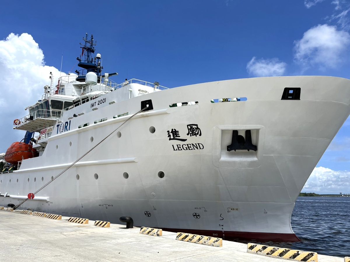
每一次颱風路徑的改變,港口船隻的航行安全,甚至一頓新鮮海鮮,都源自海下世界的運作。土木工程學系黃金維教授帶領的團隊,運用各種先進遙測工具,把海下世界逐步描繪出來。讓我們透過文章,一起到海下世界一探究竟吧!
談到這裡,我們很好奇海底地形跟我們的生活有什麼關聯。黃老師說,海底地形就像地球的巨大骨架,裡面有起伏的山丘、深邃的谷地和蜿蜒的海溝,是板塊碰撞、擠壓,以及數百萬年來海水不停沖刷共同雕刻出的痕跡。雖然我們肉眼看不到這些隱藏的地形,其實它們和我們的生活息息相關。
首先,海底地形默默影響著每天的工程與日常安全。大船進港時,需要詳細研究水底的起伏才能規劃船隻的航道,避免觸底或損壞船身。港口附近如果泥沙過多、地形變淺,原本的水深就會降低,甚至讓海浪變得更高、更強勁,海堤可能因此擋不住,城市邊緣這時就有淹水風險。
這些細微的地形改變一年到頭都在發生,也需要工程技師持續監測、即時調整設計,才能保障港口和附近民眾的安全。
海底地形也跟防災有關聯。地震學家透過海底地形資料分析哪些區域容易發生地震跟海嘯。
黃老師說明,因為海水變淺,海嘯的速度會變慢,後面的海水會不斷推擠到前面,這樣海浪就會「堆起來」,變得更高,衝擊力更強,像日本311地震那樣的巨浪突襲陸地;但如果看臺灣的花蓮,因為海底坡度陡升,海嘯衝到岸邊反而不容易積累成大浪,災害也就相對較小。科學家會使用海底數據來預測災害並做出避險規劃。
海底地形同時左右著外海風電設施、港口工程,甚至專屬經濟區 (exclusive economic zone) 劃分的權益與國家戰略。如果能用科學方法證明某片海底與臺灣本島地質是有連結的,那片海域就可以成為臺灣的資源和保護線。
持續掌握、追蹤海底地形的變化,就像定期檢查家園防線一樣,是守護安全、資源與發展的基石。海底地形需要科學家、工程師、決策者一同守護,才能讓我們與大海共存無憂。
你看過海下世界嗎?
那麼,如果想知道海底有什麼,最直接的方法之一就是從高處往下看。我們請教黃老師,他告訴我們,可以用衛星在太空中偵測海底地形,但衛星無法直接「看穿」海水然後看見海底。
衛星繞著地球飛行,配備主動發射「雷達波」或「雷射波」的儀器,會向地球表面發射訊號,不論是海洋還是陸地都能將回傳訊號收集起來。只要精確掌握衛星位置,再計算訊號返回所需的時間,就能夠推算出地表或海面的高度。
然而,這些波段訊號無法直接穿透深海,因此科學家會運用地球不同地區質量和重力產生的「微小海面高度差異」。
黃老師舉例,臺灣東部有深海溝,底下岩石密度高,在引力影響下,海水表面就會出現細微的高低起伏,衛星可以精確量測這些變化,有時甚至細微到幾公分。科學家再結合地球物理計算公式,把這些海面高度異常反推成海底地形的分布結構。
這跟我們使用相機拍照記錄光線和顏色的原理不同。衛星遙測是主動發射訊號去探測地形,而不是被動收集反射光來成像。
黃老師說明,就算我們肉眼看到的海面是平坦的,經過衛星科技和專業分析,依然可透過海面高度異常發現水面下隱藏的起伏地形。
例如,科學家在搜尋失蹤飛機時,可用衛星數據先大致鎖定海域範圍,再安排船隻進行細部探測,這樣能大大提升搜尋效率。衛星測高技術讓科學家以太空的視角,精細描繪海底地形,逐漸開啟深藏水下世界之門,讓地球的廣闊面貌一一浮現。
逐夢銀河間
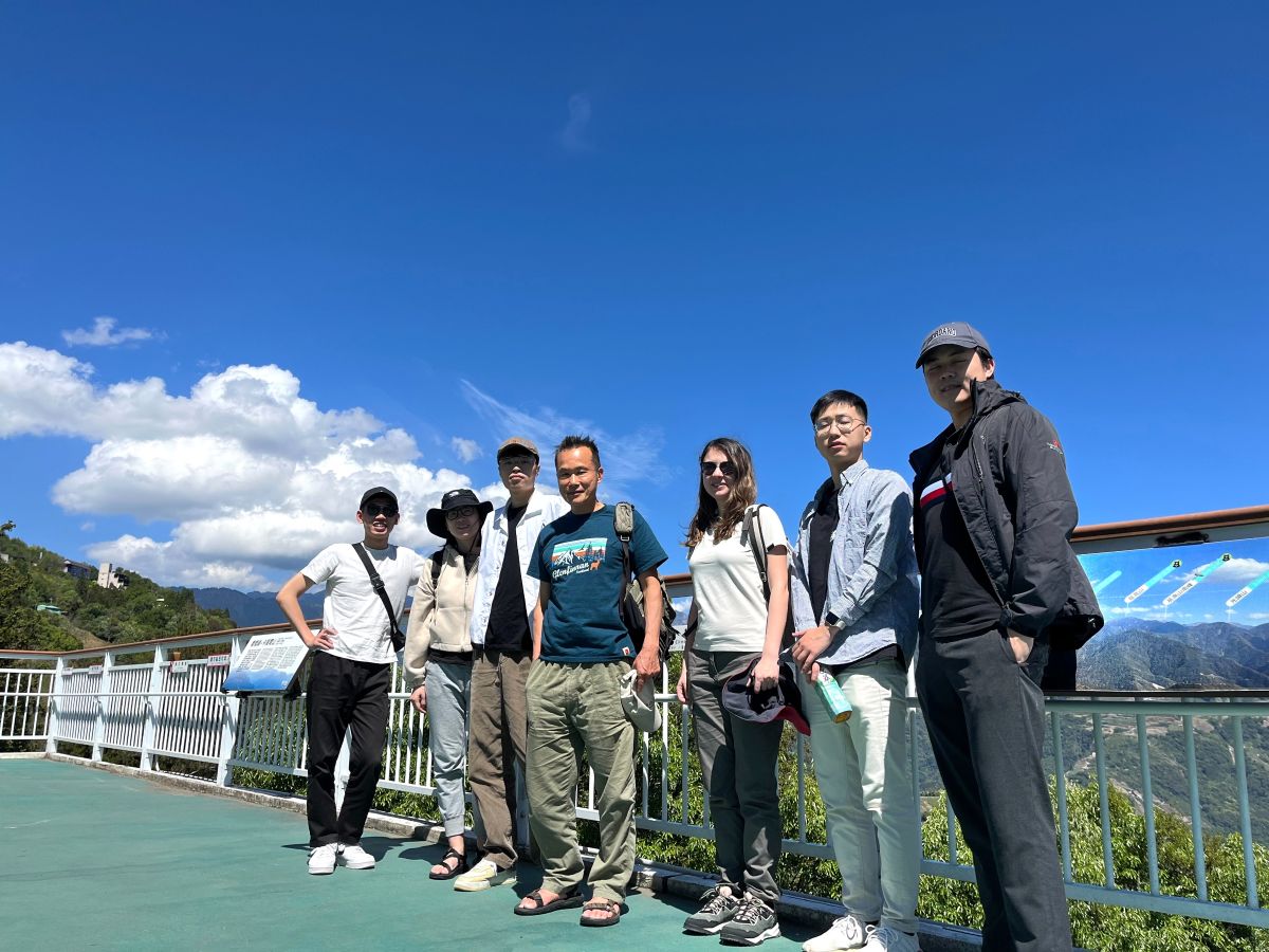
黃老師的科學生涯充滿跨界探索。透過國際合作,他的研究足跡遍及格陵蘭冰川、南海、臺灣等地,與世界各地專家攜手拼湊全球地形版圖。
在臺灣,他將所學應用在南海和臺灣的海底地形精密描測,也與團隊在實驗室裡分析資料、討論技術,讓深海下的地貌逐漸呈現在大家面前。
回顧學術生涯,黃老師與我們分享令他難以忘懷的經驗,是與國外研究團隊合作探索太平洋板塊邊緣海底地形,發現海底地形與板塊運動與地震機制間更多關聯。這一成果為地球科學推進了一大步,令他十分欣慰。
他也分享,約十年前在南太平洋大溪地做重力測量的那一晚,抬頭望見沙灘上閃耀的銀河,那片壯闊與寧靜,讓他深刻體會探索的珍貴與世界的浩瀚。
這份體會也讓他鼓勵對這領域有興趣的學生,從空間觀測、資料分析切入測量領域,結合衛星技術、人工智慧,並多嘗試跨領域合作。
其實,不論是否是科學人,只要保持好奇心並樂意嘗試,便能在學習之路遇見意想不到的美麗。
就像銀河一樣,新發現未必近在眼前,而是在探索後,悄悄照亮前方的路。不斷的探索,是推動人生前行的光芒,也讓你我的天空永遠閃亮。
大海的遼闊總讓人心胸舒展,站在岸邊聽著潮聲,煩惱似乎也隨著波浪漸漸消散。但你有沒有想過,海面之下是什麼樣的世界?我們已經知道深海裡有許多尚未被人類發現的生物,但那裡是否有海底宮殿,裡面有著寶藏?還是有一座城市?
事實上,海底深處有山脈、谷地和地層,是地球過去數百萬年碰撞、隆起與海水沖刷的痕跡。深海裡的地形與生物,與我們的天氣、海流、資源甚至日常安全密不可分。
每一次颱風路徑的改變,港口船隻的航行安全,甚至一頓新鮮海鮮,都源自海下世界的運作。土木工程學系黃金維教授帶領的團隊,運用各種先進遙測工具,把海下世界逐步描繪出來。讓我們透過文章,一起到海下世界一探究竟吧!
談到這裡,我們很好奇海底地形跟我們的生活有什麼關聯。黃老師說,海底地形就像地球的巨大骨架,裡面有起伏的山丘、深邃的谷地和蜿蜒的海溝,是板塊碰撞、擠壓,以及數百萬年來海水不停沖刷共同雕刻出的痕跡。雖然我們肉眼看不到這些隱藏的地形,其實它們和我們的生活息息相關。
首先,海底地形默默影響著每天的工程與日常安全。大船進港時,需要詳細研究水底的起伏才能規劃船隻的航道,避免觸底或損壞船身。港口附近如果泥沙過多、地形變淺,原本的水深就會降低,甚至讓海浪變得更高、更強勁,海堤可能因此擋不住,城市邊緣這時就有淹水風險。
這些細微的地形改變一年到頭都在發生,也需要工程技師持續監測、即時調整設計,才能保障港口和附近民眾的安全。
海底地形也跟防災有關聯。地震學家透過海底地形資料分析哪些區域容易發生地震跟海嘯。
黃老師說明,因為海水變淺,海嘯的速度會變慢,後面的海水會不斷推擠到前面,這樣海浪就會「堆起來」,變得更高,衝擊力更強,像日本311地震那樣的巨浪突襲陸地;但如果看臺灣的花蓮,因為海底坡度陡升,海嘯衝到岸邊反而不容易積累成大浪,災害也就相對較小。科學家會使用海底數據來預測災害並做出避險規劃。
海底地形同時左右著外海風電設施、港口工程,甚至專屬經濟區 (exclusive economic zone) 劃分的權益與國家戰略。如果能用科學方法證明某片海底與臺灣本島地質是有連結的,那片海域就可以成為臺灣的資源和保護線。
持續掌握、追蹤海底地形的變化,就像定期檢查家園防線一樣,是守護安全、資源與發展的基石。海底地形需要科學家、工程師、決策者一同守護,才能讓我們與大海共存無憂。
你看過海下世界嗎?
那麼,如果想知道海底有什麼,最直接的方法之一就是從高處往下看。我們請教黃老師,他告訴我們,可以用衛星在太空中偵測海底地形,但衛星無法直接「看穿」海水然後看見海底。
衛星繞著地球飛行,配備主動發射「雷達波」或「雷射波」的儀器,會向地球表面發射訊號,不論是海洋還是陸地都能將回傳訊號收集起來。只要精確掌握衛星位置,再計算訊號返回所需的時間,就能夠推算出地表或海面的高度。
然而,這些波段訊號無法直接穿透深海,因此科學家會運用地球不同地區質量和重力產生的「微小海面高度差異」。
黃老師舉例,臺灣東部有深海溝,底下岩石密度高,在引力影響下,海水表面就會出現細微的高低起伏,衛星可以精確量測這些變化,有時甚至細微到幾公分。科學家再結合地球物理計算公式,把這些海面高度異常反推成海底地形的分布結構。
這跟我們使用相機拍照記錄光線和顏色的原理不同。衛星遙測是主動發射訊號去探測地形,而不是被動收集反射光來成像。
黃老師說明,就算我們肉眼看到的海面是平坦的,經過衛星科技和專業分析,依然可透過海面高度異常發現水面下隱藏的起伏地形。
例如,科學家在搜尋失蹤飛機時,可用衛星數據先大致鎖定海域範圍,再安排船隻進行細部探測,這樣能大大提升搜尋效率。衛星測高技術讓科學家以太空的視角,精細描繪海底地形,逐漸開啟深藏水下世界之門,讓地球的廣闊面貌一一浮現。
逐夢銀河間
黃老師的科學生涯充滿跨界探索。透過國際合作,他的研究足跡遍及格陵蘭冰川、南海、臺灣等地,與世界各地專家攜手拼湊全球地形版圖。
在臺灣,他將所學應用在南海和臺灣的海底地形精密描測,也與團隊在實驗室裡分析資料、討論技術,讓深海下的地貌逐漸呈現在大家面前。
回顧學術生涯,黃老師與我們分享令他難以忘懷的經驗,是與國外研究團隊合作探索太平洋板塊邊緣海底地形,發現海底地形與板塊運動與地震機制間更多關聯。這一成果為地球科學推進了一大步,令他十分欣慰。
他也分享,約十年前在南太平洋大溪地做重力測量的那一晚,抬頭望見沙灘上閃耀的銀河,那片壯闊與寧靜,讓他深刻體會探索的珍貴與世界的浩瀚。
這份體會也讓他鼓勵對這領域有興趣的學生,從空間觀測、資料分析切入測量領域,結合衛星技術、人工智慧,並多嘗試跨領域合作。
其實,不論是否是科學人,只要保持好奇心並樂意嘗試,便能在學習之路遇見意想不到的美麗。
就像銀河一樣,新發現未必近在眼前,而是在探索後,悄悄照亮前方的路。不斷的探索,是推動人生前行的光芒,也讓你我的天空永遠閃亮。
By Ting En Yen
Image courtesy of Professor Cheinway Hwang and the Secretariat
Image courtesy of Professor Cheinway Hwang and the Secretariat
How the world beneath the waves shapes our lives
Being in the presence of the vast ocean has a way of opening the heart. Standing on the shore, you may listen to the rhythm of the tides and feel your worries recede with each wave. But have you ever wondered what lies beneath the waves?
Although we know that deep seawaters harbor countless species still undiscovered by humans, is it possible that there could also be a palace down there, filled with hidden treasures? Or even a lost city?
People who study the ocean floor have shown that it is shaped by mountain ranges, valleys, and ancient geological layers. Scars and imprints on the ground beneath the waves stand as a testament to millions of years of tectonic collisions, uplifts, and ceaseless washing by the tides.
Intriguingly, scientists have also shown that both the terrain and the creatures of the deep sea are closely connected to our weather patterns, ocean currents, natural resources, and even our everyday safety.
The shifting path of a typhoon, the safe passage of ships in a harbor, even a plate of fresh seafood are all connected by the hidden workings of the underwater world.
To reveal how this mysterious realm appears and functions, Professor Cheinway Hwang and his team in the Department of Civil Engineering use advanced remote sensing technologies that can allow us to catch small glimpses of the world beneath the waves.
Through steady efforts and careful analysis, these small glimpses can show us the big picture of the ocean floor.
You might ask “what does seafloor topography actually have to do with our everyday lives?” According to Professor Hwang, the seafloor acts like Earth’s massive skeleton, with its rolling hills, deep valleys, and winding trenches. Even though these hidden features exist beneath the surface, they closely affect our lives.
One reason to understand the shape of the ocean floor is that its contours play a critical role in the engineering and safety of ships. For instance, when a large ship enters a port, it must follow a safe route to prevent it from running aground or getting damaged.
However, the safe routes of yesterday may not still be safe today, as the ocean floor shifts and changes. Also, if too much sediment builds up near a harbor and the sea gets shallower, the waves can become taller and rougher.
In such cases, old breakwaters may not provide enough security, and a coastal city could face a risk of flooding. Since these kinds of subtle changes happen over the course of years, engineers must continually monitor the seafloor and adapt their designs to ensure ports and nearby communities stay safe.
Knowledge of seafloor topography is also important for disaster preparedness. Seismologists can use data about the shape of the ocean floor to analyze which areas are most susceptible to earthquakes and tsunamis. As Professor Hwang explains, a tsunami will slow down when the water becomes shallower, and the waves behind will keep pushing it forward.
This will cause the water to stack up and the waves to grow taller and more powerful, like the massive waves that struck land during 2011 Tōhoku earthquake and tsunami. In places like Hualien, Taiwan, where the seabed rises steeply, an incoming tsunami is less likely to build into a towering wave, so the impact should be less than it was in Japan.
In this way, scientists can use data about the seafloor to predict the outcomes of disasters and develop suitable safety measures.
Seafloor topography also affects offshore wind farms, port engineering, and even the boundaries and strategic interests of exclusive economic zones.
If scientific evidence shows that a particular stretch of seabed is geologically linked to Taiwan, that area can be considered part of Taiwan’s resources and becomes a line of defense.
Continuous monitoring and tracking the changing shape of the seafloor is as essential as routinely checking the defenses of a home.
It is the foundation that keeps our safety, resources, and development secure. Scientists, engineers, and decision-makers must therefore work together to understand the ocean floor and manage its impacts.
Peering beneath the ocean surface
It stands to reason that if you want to see what lies on the seafloor, the most direct way to find out would be to look down from above.
When we asked Professor Hwang about this idea, he explained that although satellites in space can be used to detect the shape of the ocean floor, they cannot be used to simply “see through” seawater and capture images of the bottom.
Instead, satellites orbit Earth carrying instruments that actively send out radar or laser signals toward the planet’s surface. Whether the signal hits land or ocean, it bounces back and gets recorded.
By precisely tracking the satellite’s position and calculating the time it takes for the signal to return, scientists can measure the distance between the satellite and the Earth. This information will allow them to calculate the elevation of the Earth’s surface or the height of the sea surface.
The challenge to using this method is that the radar and laser signals cannot penetrate deeply into the water.
To get around this limitation, scientists can instead track tiny variations in height of the sea surface that are caused by differences in the Earth’s gravity directly below. Professor Hwang gave an example to illustrate how this might work.
Off Taiwan’s eastern coast lies a deep ocean trench. Because the rocks below are dense, they exert slightly stronger gravity, which in turn shapes the water above into barely noticeable bulges or dips at the surface. Satellites can precisely measure these tiny changes, sometimes down to just a few centimeters.
Using mathematical models from geophysics, researchers can then work backward from these surface anomalies to reconstruct the topography of the seafloor.
This method is not like a camera that collects information about light and color coming from the object. Instead, this type of satellite remote sensing requires the satellite to actively send out a signal in order to probe the terrain.
Professor Hwang pointed out how effective this method is. He said that even when the sea looks perfectly flat to the naked eye, advanced satellite data and professional analysis can still detect tiny differences that reveal the hidden mountains and valleys beneath.
Aside from looking for lost cities and palaces, the technology has many practical applications. For example, when scientists search for a missing airplane over the ocean, they can use satellite data to narrow down the search area before deploying ships for detailed scans, greatly improving search efficiency.
As this type of satellite altimetry technology gives scientists a bird’s-eye view from space, they are able to map the contours of the ocean floor with increasing precision. Bit by bit, the hidden underwater world comes into view, helping us look upon the vast and complex face of our planet.
Chasing dreams beneath the stars
Professor Hwang’s scientific journey has been one of interdisciplinary exploration. Through international collaborations, he has researched glaciers in Greenland, mapped the South China Sea, and studied the ocean floor around Taiwan, working alongside experts from around the world to piece together a global map of Earth’s surface.
In Taiwan, he applies his expertise to precise mapping of the South China Sea and the island’s underwater terrain. His team works tirelessly, analyzing data and discussing techniques in the lab, gradually and progressively bringing the mysterious deep seafloor into view.
When asked to look back on his academic career, Professor Hwang shared one of his favorite experiences. He had joined an international team to survey seafloor topography near the edge of the Pacific Plate.
In their research, the team discovered new connections between the shape of the seafloor, plate movements, and earthquake mechanics. This breakthrough helped to propel earth science forward, and his part in the effort filled him with pride.
He also recalled a night about ten years ago in Tahiti, where he was working on gravity measurements. Standing on the beach and looking up, he saw the vast Milky Way shining overhead. He was struck by its grandeur and stillness, a vivid reminder of how precious and wide the world of exploration can be.
Reflecting on these moments, Professor Hwang encouraged students who might be interested in this field to start by learning about space-based observation and data analysis. Then, they can interweave these classical analyses with satellite technologies, artificial intelligence, and cross-disciplinary teamwork.
He also emphasized that whether someone is a scientist or not, staying curious and willing to try new things will surely bring unexpected beauty into the journey of learning.
Like the Milky Way, new ideas may be difficult to see from inside our comfort zones. But after venturing into the unknown, the discoveries we make can quietly light the road ahead.
